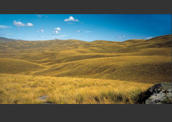
Some upland areas of Central Otago retain remnant old peneplain surfaces. Incredibly, the sea once invaded this landscape, at least as far as Naseby in the Maniototo. This happened, up to 20 times, in the Oligocene period, some 25 to 40 million years ago, when New Zealand was a collection of low-profile islands.
The landscape today bears no resemblance to those times. Nor does the climate, which is largely controlled by the rise of the Southern Alps to the west, where Mt Aspiring/Tititea, is the only mountain outside Aoraki/Mount Cook National Park over 3,000 metres in height.
Formed by uplift along one of the world’s most conspicuous tectonic plate boundaries, the Alps are rising in the order of 10 to 20 mm a year, which is about the rate at which fingernails grow. In geological terms, this is meteoric. At the same time and at roughly the same rate, they are losing height by erosive processes powered by climate.
The Alps and the Fiordland mountains to the south form a wall that intercepts the moist airstreams advancing steadily eastwards across the Southern Ocean. The repercussions of this are two-fold: first, a West Coast environment that ranks as one of the world’s wettest areas, where rainfall is measured in metres annually, and second, the creation of a ‘rainshadow’ region east of the main divide, largely protected from the worst of the wet weather. This region is Central Otago; hot in summer, cold in winter, and dry much of the year, a continental climate of sorts. Geographers describe it as semi-arid and subcontinental.
The driest place in New Zealand is the area around Alexandra. Here, rainfall is little more than 300 mm a year. As for cold, Central also holds the national record. On 3 July 1995, after several foggy sub-zero days, the temperature hit a metal-cracking minus 21.6 degrees Celsius at the old goldfield township of Ophir.
The region has known colder times still. Two and a half million years ago, when the Earth cooled and ice spread across the higher-latitude regions of the world in a series of ice ages, glaciers began carving future valleys, fiords and lake beds. Warm periods between the ice ages, lasting thousands of years, together with the presence of refuge areas in the landscape, allowed elements of the plant and animal life to survive, often through adaptation.
The alpine parrot kea of the western mountains, for example, evolved during the ice ages – an offshoot of its forest parrot relative, the kaka. Numerous new plants evolved to cope with the colder, higher environments, including some mountain daisies. A high proportion of New Zealand’s endemic plants are found in the alpine zone, and in the ranges of Central as well as on the dry valley floors, the region claims its fair share of unique species.
Some areas are curiously salty and harbour specialised plant communities. There are mini-saltpans and areas of saline soils in various parts of Central Otago and South Canterbury – the only such features in New Zealand. At Sutton near Middlemarch is the country’s only salt lake worthy of the name.
Further challenges to plant life and their associated insect and vertebrate communities are found on or near the summit crests, where extreme weather conditions have forced the vegetation to adopt the stature of tundra.
|


